The Space Data Lab enables innovation
Earlier this fall, the space data hackathon “Copernicus Hackathon” invited teams to make use of data from the Space Data Lab and other sources, to solve challenges related to climate change, life on land and COVID-19. We spoke with the Swedish team Backtick Technologies - one of the first external users of the dataset - to understand how they used the Space Data Lab and what solutions they came up with.
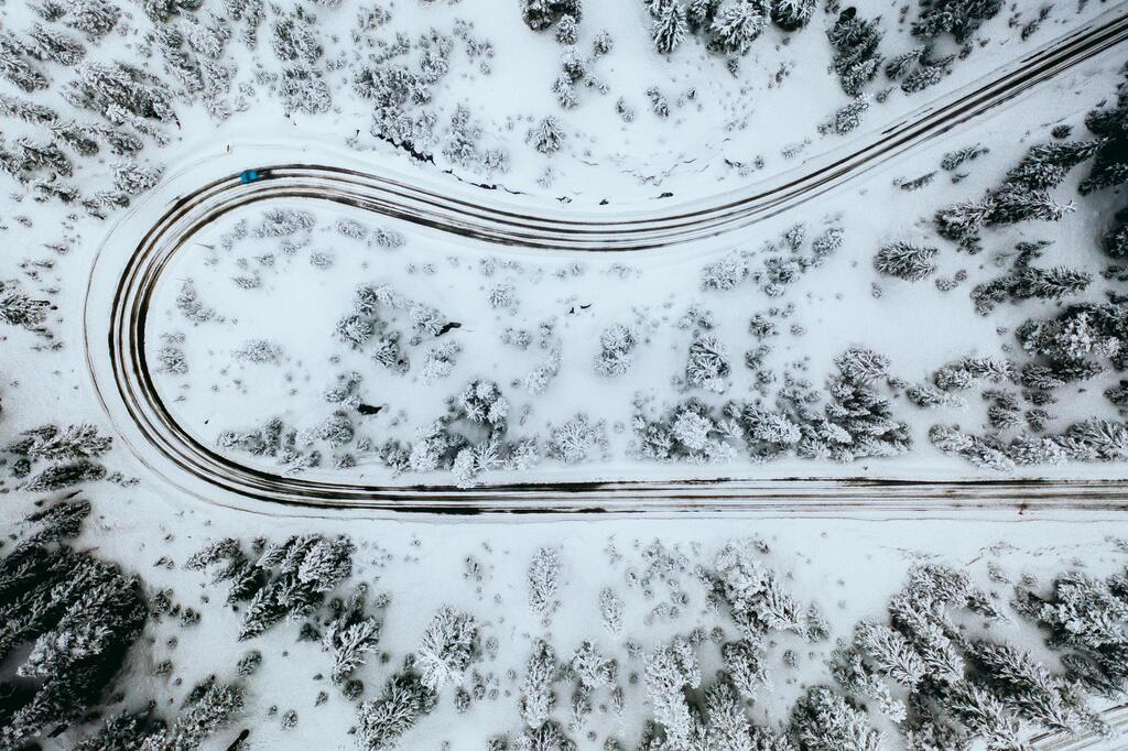
How can satellite data be used to predict road conditions, even where there are no images? Backtick Technologies was one of the teams involved in the hackathon, aiming to answer this question. By combining satellite data with their own calculation models and linking this with road data, they were able to present a solution that in the future can contribute to creating both safer roads and more efficient road maintenance.
Backtick Technologies, consisting of Oskar Handmark and Fredrik Olsson, managed to get all the way to the final and finished third place with their idea based on the hackathon's challenge "Snow and Cloud Detection". By combining satellite data with the geographical position of roads and other map data about the roads, the goal was to use their model ARCIF - Arctic Road Condition Indexing & Forecasts - to estimate the road conditions on all roads, even where there were no images.
To develop their idea, the team gained access to satellite data from Copernicus, as well as the Space Data Lab's OpenDataCube, and thus became some of the first external users of the platform.
Oskar Handmark and Fredrik Olsson, Backtick TechnologiesTell us about your idea?
The solution we chose to work with is a model we call ARCIF - Arctic Road Condition Indexing & Forecasts. The model identifies areas of snow / ice / clouds on satellite images. The idea was based on combining the results from this model with existing images from street view (Google, Mapillary) and image segmentation models for these images.
Together with the geographical position of the roads and other attributes such as their size, one can estimate the road conditions on all roads, even where there is not enough data. Since satellite photos have a relatively high resolution compared to street view data, it is possible to combine the time series it creates with weather forecasts to estimate the road conditions in the future.
We see a number of possible areas for this, including improved traffic safety, self-driving cars, resource prioritization (for maintenance, etc.) Analysis of accidents and Predictive maintenance
Did it go as you hoped?
In general, we are satisfied with what we achieved during the hackathon. The model we implemented for identifying snow / ice / cloud areas worked very well (UNet structure with pre-trained encoder part. 91% pixel-wise accuracy) and our idea to use it for ARCIF felt interesting and useful.
Probably the biggest challenge was the lack of annotated data for training and evaluation. Here we instead had to use data from certain satellite bands to construct annotated data for image segmentation. There was also a lack of sufficient amounts of street view data.
"Overall, it worked great to work with the Space Data Lab's OpenDataCube. The API was easy to use and together with the sample code provided by the hackathon, it was easy to get started and retrieve satellite data."
The only downside really was that it took quite a long time to retrieve image data. Therefore, we tried to save as much data on disk as possible, to be able to maximise the use of the graphics cards in the training phase.
Hackathons as catalysts for new solutions
Within the Swedish Space Data Lab project, hackathons are an important part of the development work, and involve a large group of potential users.
"Hackathons are not only very fun, but also an opportunity for new talent to get involved in a context where innovations become reality and a chance to try new ideas," says Viktor Lehtonen, Project Manager for the Swedish Space Data Lab.
“It is also a way for us within the project to expand the user base and spread the knowledge about the data that is available within Copernicus. For many, satellite data is something completely new and we are happy to introduce it to more people. We already today see how satellite data is used in a number of different ways and in the future this will only increase, especially in combination with artificial intelligence.”
Oskar Handmark agrees. “It's amazing that the hackathon took place, otherwise we probably would not have started exploring use areas for satellite data as quickly. The Space Data Lab and the organizing parties are obvious partners in future projects, primarily as a catalyst for new services and applications.”
“We have become very interested in satellite data and are currently investigating other use cases and product ideas and also plan to participate in a major hackathon (ActInSpace 2020) for similar ideas.“
Read more about the methods behind Backtick Technologies' solution here.
About Copernicus Hackathon
The Copernicus Hackathon was organized by Arctic Business and Innovatum Startup September 26-28, 2020, with a record number of participating teams from across Europe. A total of 58 teams from seven countries participated in the hackathon to find solutions to seven different challenges related to climate change, life on land and COVID-19. The teams gained access to satellite data from Copernicus, which was made available through the Swedish Space Data Lab, among others.
The solutions were evaluated based on the following evaluation criteria: Relevance to the topic, project interest and team quality.
The winning team was awarded with 20,000 SEK and a place in Copernicus Accelerator went to the team WaterFinders, based in Germany and Italy.
Read more about Copernicus Hackathon Sweden
View the winning presentation here.

Follow us
AI Sweden Newsletter
Sign up for the latest in Swedish AI
AI Sweden is formally hosted by Lindholmen Science Park AB.